
 |
Introduction:
When someone thinks of or talks about rivers in the Guwahati city, the first name that comes to one’s mind is the Brahmaputra, the mighty river that flows by the northern side of the city. However, Brahmaputra is not Guwahati’s own river; it does not belong to Guwahati alone. Brahmaputra touches Guwahati in the mid of its long course of journey. It even does not flow through the city, but by the city. The city of Guwahati lies on the southern bank of the Brahmaputra. In that way, Guwahati is actually another place by the side of mighty Brahmaputra.
It’s not Brahmaputra, but the Bharalu river or rather the Bahini-Bharalu and Basitha river which flow through the heart of the city are the two main rivers that can be termed as the city’s own river. Almost across the whole city from Beltola to Bharalu, or Kahanapara to fatasil one can see these two rivers, though in its sad form of a drainage system. One cannot avoid seeing these rivers if one makes a round of the Guwahati city. The Guwahati city, if one would like to term, it as a settlement or a civilization, then it is the civilization of the Bahini-Baharlu valley.
Along with Mora (dead) Bharalu, Silsako bill, Bondajan channels, Bahini-Bharalu are the natural drainage channels of the northern and eastern part of the city and Basistha is the only river located in the southern part of the city. Unfortunately, with the growth of the modern Guwahati city these rivers are reduced to or have become mere drains. Only in portions, the remains of the rivers can be felt or seen.
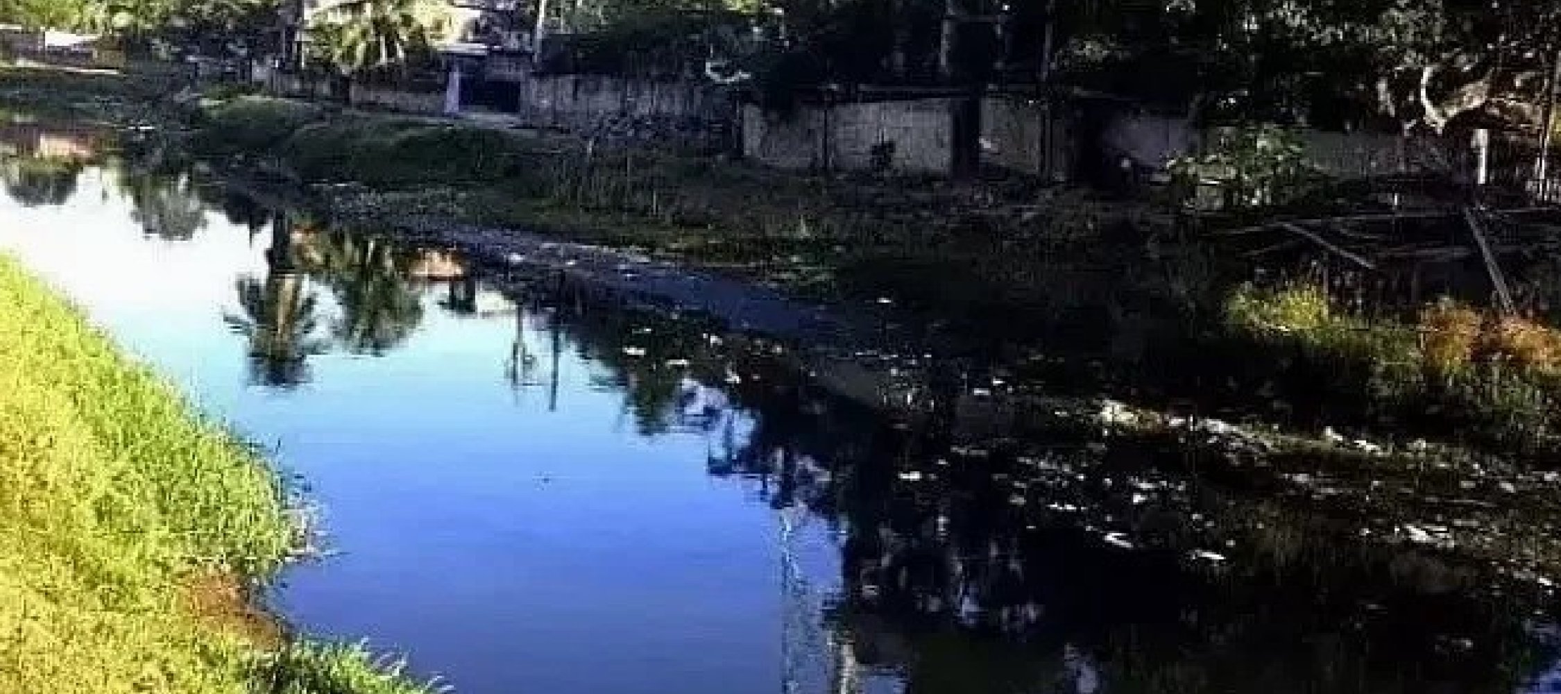
The Bharalu river, which could have been the heart line of Guwahati city and could become an ornament of the city is now mostly mistaken for a garbage carrying drain. Same can be said for Basistha River too. If one search for the Bharalu river in googgle, the 3rd sentence on the river goes like this- ‘Bharalu river is one of the most polluted rivers in the state of Assam. Such is the fate of this river, which is studied mostly for its pollution status, and no other memories and stories are told about the river.
Bashistha and Bahini-Bharalu are two significant peninsular types of rivers flowing in the southern bank of the Brahmaputra River. The plain portion of this part of the Guwahati city topographically is the valley of the river Bharalu which has been expanding upstream and sideways since remote past. But in present days both the rivers create water logging and flood hazards within the Guwahati city.
Locating the Rivers:
It is important to mention here that the Bahini-Bharalu river is mostly popular as Bharalu river. People hardly know the name Bahini, which is the original river. Bahini becomes Bharalu only in Zoo Road, where it takes turn to the western side. Beyond Beltola or Ganeshguri, people are hardly aware of the name Bahini. Even people who has business establishment by the side of Bahini river, does not know its name. I had spoken to many people who have shops by the side of the Bahini river in R.G.B. Road are not aware of the fact that they are by the side of the Bahini River. They take the river as a Nala or drain only. Same way Basistha River which flows in the southern part of the river has also lost its identity and characteristic.
While for commoners these rivers look like mere big drains only, an enquiry to the origin of the rivers and visit near original areas bordering Meghalaya, will make one aware of its river characteristics and of its pure form. It should be mention here that both the rivers originate in Meghalaya.
Few researchers have talked about the origin of these rivers. There is not much research work on these rivers, if it is there then it is from the pollution perspective. These rivers no more contribute to livelihood of people of the city. However, on some occasions one can spot people fishing in the Basistha River, even in the present time.
It is important that we locate the rivers to understand its origin. As mentioned earlier, both Bahini-Bharanalu and Basistha rivers have its origin in Meghalaya. This is what research have pointed, as well as if one can travel by themselves to find the origin. For example, if we go to Basistha temple, we can easily see Basistha River coming from upper side of Meghalaya just by behind the temple.
Bashistha and Bahini-Bharalu are two significant river basins of southern bank of the river Brahmaputra which constitute a part of Kamrup and Kamrup Metro districts of Assam and Ri Bhoi district of Meghalaya. The length of Bashistha River is 33.12km, while the length of Bahini-Bharalu River is 30.02 km. (Devi & Sharma, 2015:183)
According to one research work the Basistha River owes its genesis from the northern part of the East-Khasi Hills district from the Mount Jatabor peak of Garbhanga Reserve Forest in Meghalaya, at an elevation of 780–638 m above sea level. The Basistha, with its many small tributaries, cuts through a major part of the reserve and initially drains into the Bahini river. Finally, the river drains into Deepor Beel. From Mount Jatabor peak, it originates as river Barpani and joins the Akhari or Khorupani river on its path. These two rivers Akhari and Barpani forms the physiographic boundary between Kamrup district of Assam and East Khasi Hills district of Meghalaya and extends up to Garhjula hills for a distance of 10 kms towards the North eastern direction. Before reaching the Basistha temple the river travels parallel to the Patalia river. The lower portion of the river (3.5 km), which was about one to three meters wide with a depth ranging from six centimeters in fast flowing parts to 120 cm in the deepest pools The river flows through southern part of Guwahati City and outfalls at Morabharalu near Katahbari (Barpujari and Gogoi,2015:128).
Presently another stream, near Bakrapara, a new stream had been manually diverged towards western direction. The main course of the river Basistha travels from Basistha chariali to 500mtrs towards the west along the NH-37 and turns northward and reaches Hatigaon. From Hatigaon it gradually travels in the west and turns southward direction and reaches Sonaighuli (Barpujari and Gogoi,2015:128).
Earlier the Basistha River from Sonaighuli region flows downsteam and diverges into two courses, one travelling westward and reaches the Deepor Beel and another travelling in the northern direction, joins the Bahini river to form the Bharalu river. Presently the Basistha River travels 2 kms south westward from Sonaighuli and near Fatashil Katahbari region turns southwards. This way after crossing, a route of half kilometres it travels along with the Jajoa river in the left and turns westward. Again, surpassing a 500-meter-long route, it crosses the NH 37and travelling along the right side of Sukhoja river forms the Mora-nola. The river flows westward for a distance of 2 kms and combines its course with a stream running from the South Fatashil Reserve Forest of Maligaon in the right and Panchdhara river in the left and flows 4 kms to reach the Deepor Beel. The length of the river from source to its outfall at Deepor Beel is 27 kms. (Barpujari and Gogoi,2015:128-129)
Same as Basistha, the Bharalu river has its origin in the in the foothills of the Khasi Hills of Meghalaya. Bharalu enters Guwahati through the South eastern corner. It is known as the Bahini or Bihini in its upper reaches. The Bahini finds its way thorugh inhabited areas of Basitha, Beltola, TOngora Satra, Rukmini Gaon, Mathura Nagar, Dispur, Hengarabari, Ganeshguri and along the R.G. Barua Road. The Bahini, as the Bharaulu is known, meets a major drain (carrying stormwater runoff from the public sector Guwahati Refinery, Indian Oil Corporation Limited and Domestic Wastewater from a large area in the eastern part of the city) near Assam State Zoo and thereafter assumes the name, Bharalu. At this point Bharalu makes a sharp westerly turn, crosses. R.G. Barua Road and flows through a dense residential area consisting of Rajgarh (Lal 1992:1-2). Bharalu on its western journey crosses G.S. Road at Bhangagarh and then reaches Ulibari, Fatasil and Kumarpara. After crossing Kumarpara it joins Brahmaputra at Bharalumukh.
According to a report of Pollution Control Board, Assam the natural flow of Bahini River has been totally blocked at Natun Bazar area of Basistha Chariali locality with the help of sluice gate. The Bahini river then flows through Lalmati area near Water Resource department where it meets Basistha River and then finally travels as Basistha Bahini River finally to confluence with Deepor Beel. Bahini River from Bakrapara area in Basistha Chariali now becomes a sewerage drain as the natural flow is obstructed at Natun bazar area. It then travels below NH at Beltola and through major areas like AG office Road, Krishnapur, Saurabh Nagar, Rukminigaon, Downtown area, Ganeshguri, Hengerabari, Zoo Road and finally confluences with Bharalu River at Jonali point carrying all the city sewage including commercial sewage. There is no natural flow of the river at present and only the domestic sewage and commercial sewage are being carried away by the river. It is also observed that the river banks are being encroached specially from Sarabbhati area to the confluence point and hence at many places it is becoming narrower as a result of encroachment.
The river mainly flows through 7 wards out of total 39 wards in the Bharalu river catchment area. The city of Guwahati lies on the southern bank of the Brahmaputra and straddles the valley of the river Bharalu which is a small tributary of the Brahmaputra. The Basistha-Bahini -Bharalu are the trunk channels in the city and along with their host of tributaries form the main conduit for surface water runoff (Gogoi & Rashmi, 2017: 2)
Between Basishtha and Bharalumukh the river has a stretch of about 10.2 km and a bed width of about 9 to 5 meters. The depth of the flow is not uniform, the average depth being about 3 meters. The velocity of the flow is estimated at about 0.76 m/sec for the stretch between Basishtha and R. G. Baruah road and 1.07 – 1.37 m/sec for the rest of the course. The average discharge at Bharalumukh is 71500 liters/sec. The stretch of Bharalu and Bahini which traverses through the populated areas of Guwahati is approximately 16 km long with a catchment area equally divided between the hilly regions and the plains. The hilly upstream section of the Bharalu has a catchment area of 60 km2 (where it is known as Bahini), and a catchment area of 40 km2 in its downstream stretch passing through Guwahati It discharges into the Brahmaputra at Bharalumukh. The original channel bifurcates into two rivulets after flowing a few kilometers. One rivulet known as the Basistha River flows towards Deepor Beel. The other rivulet (initially called Bahini and later Bharalu) passes though the city (Gogoi & Rashmi, 2017:3).
From River to Drain: Journey of a Few Decades
In 2019, from 5th to 16th November a festival named Brahmaputra Pushkar & Sanskritik Mahotsav Mela 2019 was organized in Sonaram Field by the bank of Brahmaputra where thousands of devotes were gathered. During the festival, the district administration had closed the sluice gate of the Bharalu to minimise the pollution level of the Brahmaputra during the PushkarFestival as the devotees would take bath in the river. Also, the Water Resources Department diverted the Bharalu river water through the Mora Bharalu to Deepor Beel. As a result, the Bharalu river was being buried in plastic garbage during that time. The heaps of plastic waste blocked the flow of water in some places in the city. On November 8, 2019, a new report was published titled ‘Shocking! Bharalu River Clogged with Tones of Plastic’ where it was informed that the heaps of plastic waste are so thick at some places that it’s blocking the flow of water through the city (Time 8, 2019).
The locals alleged that due to the blockade, the water level with the plastic waste of the river is rapidly increasing. The Anil Nagar residents and commuters passing by the river complained of rancid smell and fear diseases. “The way the water level and waste is increasing, the river will throw back all the garbage that was disposed of in it in the next two days,” said a local. (Time 8, 2019). This small news actually shows the pathetic condition of the river, as well as the possible danger of a polluting river. Within few decades Bharalu transformed from a river to dangerous polluting river which is now threat to the environment.
Whether Bharalu or Basistha, these rivers were not always drains. Due to the absent of a sewage network in the city these rivers became drains or sewage canel. It seems, river like Bharalu lost its river characteristics in the post 1985 with rapid demographical change of the city and due to negligence of authorities.
Many people have memories of a river with Bharalu rather than of drain, particularly those who have spent their time by the side of river before 70s or 80s. Prof. Kalyan Das mentioned in an interview that they use to play in the water of Bharalu river. “In the 1970s, when I was a child, our house was next to the Bharalu river. That time the river water was clean and we used to play in it and catch fish. During festivals, people from the neighbouring villages used to come to catch fish, too,” he further added, ‘Gradually, the river water quality started to deteriorate and post 1985, Bharalu river turned into a drain, which now only carries polluted water and untreated sewage of the city’ (Jamwal, 2020). Similar with the feelings of Kalyan Das, writes Satyabrat Sarma that one of his friends from Tezpur who visited Guwahati during his student life most probably in the 1960s took bath in the Bharlu river. He used to visit his maternal uncle’s home at Guwahati whose house was by the side of Bharalu river. As water in the ring well of the house was not sufficient men in the house had to take bath in Bharalu river every day and they had to carry two buckets of water for ladies of the house (Sarma, 2022).
It’s really disheartening to see the present condition Bharalu and how it transformed from a river to sewage cannel within a span of four decades. It became a sewage cannel because it receives all the dirt of the Guwahati City as it does not have a sewage network. It is very interesting and horrifying to know that a proposed smart City does not have sewerage network.
Let us have an idea about major waste stream and inputs that enters Bharaul from various parts of Guwahati. As per a report by the Pollution Control Board, Assam; the major waste streams that enters Bharalu are:
Along with above mentioned waste streams, North East Development Agency (NEDA), observes that Biomedical waste from hospitals near Bharalu is believed to find its way to the drains and municipal solid waste stream dumped in the river (North East Development Agency, 2020). The exact numbers of hospital are Guwahati is not our knowledge, but is surely more than one hundred as a website has listed best 100 hospitals in their website.[2] One can imagine the kind of biomedical waste is produced by the hospital is Guwahati.
In absent of sewage network, Bahini Bharau river is working as the sewage network of the city. Almost, all drains in the city whether big or small finds its way to Bahini-Bharalu river. In his research work, Prem Chndra Lal had mentioned about 6 major inputs to Bharalu which carried waste to the river. According to his finding the major inputs in that time were as follows:
Along with the above-mentioned inputs, another research work done in 2017, has mentioned the following secondary drains as major inputs to the river.
The actual numbers of drains have surely increased in last year both major and minor. NEDA in 2020 reports says about 39 drains empty into Bahini-Bharalu river, dumping Guwahati city’s waste to the river system (North East Development Agency, 2020)). On the other hand, Sarma pointed out that 56 numbers of waste drains have been connected to Bharalu among which 17 are big drains (Sarma, 2022).
In 2018, Central Pollution Control Board (CPCB) had classified Bharalu as one of the critically polluted rivers in India and put it in priority-I river stretch: the maximum Biological Oxygen Demand (BOD) found in the river water was 52 mg/l. A higher BOD means that microorganisms are using up oxygen to decompose organic matter, and that reduces oxygen availability for aquatic lives. A BOD of 3 mg/l is desirable for healthy rivers. The dissolved oxygen content of the river remains nil during most times. Heavy metals, inorganic contaminants such as nitrate and fluoride and petrochemicals, pesticides and pathogens have been detected in Bharalu (North East Development Agency, 2020)
The Pollution Scenario:
In September 17, 2018, a news report titled “More River Stretches are now Critically Polluted: Central Pollution Control Board” was published in The Hindu written by Jakob Koshy. The report stated that according to an assessment by the Central Pollution Control Board (CPCB), the numbers of polluted stretches of the country's rivers has increased to 351 from 302 two years ago, and the number of critically polluted stretches — where water quality indicators are the poorest — has gone up to 45 from 34. While the Rs.20,000 crore clean-up of the Ganga may be the most visible of the government’s efforts to tackle pollution, the CPCB says several of the river’s stretches — in Bihar and Uttar Pradesh — are actually far less polluted than many rivers in Maharashtra, Assam and Gujarat. These three States account for 117 of the 351 polluted rivers stretches (Koshy, 2018). This has become a big concern, as Assam is a state with much less industrial infrastructure in comparison to Gujarat and Maharashtra. In Assam, a total of 44 rivers flowing are marked as polluted river stretches which is the highest among all Northeastern states of India (Borah, 2019).
Of the 44 polluted river stretches in Assam, three rivers — Bharalu with river stretch from Guwahati to Chilarai Nagar, Borsola stretching along Sarabbhati area in Guwahati and Silkaso in Chachal area of the city are marked under priority 1 of the polluted river stretch as per CPCB with a BOD level of 52.0 mg/l, 34.0 mg/l and 34.0 mg/ l, respectively, and the actions plans for the same are yet to be received by the CBCB. (Borah, 2019).
After Publication of this news report the National Green Tribunal (NGT) issued an order on 20 September and 19 December, 2018 directing all states and union territories of India to prepare action plans for bringing all the polluted river stretches to be fit at least for bathing purpose (scientifically biochemical oxygen demand (BOD) less than 3 milligram per liters and faecal coliform (FC) less than 500 most probable number (MPN) per 100 liters) within a provided time span of six months from the date of finalization of the action plans ( Borah 2019). Accordingly, Assam Pollution Board came up with an Action Plan for Bharalu River. Government of Assam constituted a River Rejuvenation Committee (RRC) vide memorandum 673/2018 dated 19/12/2018 for effective abatement of pollution, rejuvenation, protection and management of the identified polluted stretches, for bringing the polluted river stretches to be fit at least for bathing purposes within six Months (Pollution Control Board, 2022).
According to the report of Pollution Control Board, the length of the polluted stretch of Bharalu River is 6.20 KM with an area of 109 sq.km. The stretch identified as polluted is from Jonali point to Bharalumukh. The encroachment on the river banks is spreading due to which the width of the river is becoming narrower and shallower (Pollution Control Board, 2022). However, the Bahini part of the river is not less polluted it seems. This can be easily assumed if one makes a visit various area of the Bahini River whether in Beltola area or in Downtown area.
The Problem:
It’s surprising but true that the city of Guwahati, which is an upcoming smart city is not covered by any sewerage network, a must for city like Guwahati. Unfortunately, we do not see any such plan in that line, which means Bahini-Bharalu will continue to be the sewage canal for the near future too. If we accept that as a given condition, then what we need is sewage treatment plants for the city. However, it seems it is also not there at present.
A March 2021 national inventory of sewage treatment plants (STPs) by India’s pollution watchdog, the Central Pollution Control Board, points out that there is no sewage treatment plant in Assam. While smaller states and island territories in India (Nagaland, Manipur, Meghalaya, Andamans and Lakshadweep) also lack STPs, Assam is the most populous state without this key infrastructure (Padmanaban, 2021). This is was earlier confirmed by former Deputy Commissioner of Kamrup Metro Biswajit Pegu in an interview in 2020. “Guwahati is selected as a Smart City and there are plans to set up municipal sewage treatment plants. But, at present, there is no such facility in the city,” he informed to Gaon Connection. “Bahini-Bharalu river carries the main load of untreated sewage of the city. Some of the untreated
In addition to this former chairperson of Assam Pollution Control Board Y Suryanarayana told that not just Guwahati, there is no municipal sewage treatment plant anywhere in Assam. “Residential and commercial complexes have their own underground septic tanks whose regular cleaning is the responsibility of Guwahati Municipal Corporation. There is no centralised sewage collection and treatment system in the city,” he added (Jamwal, 2020).
This is what we find out when we narrow down the issue of Bahini-Bharalu River it becoming a sewage cannel or drain or in terms pollution that we don’t have sewage network and sewage treatment Plant for the city. Separate sewage network can be a distant dream, but STP should not be one.
References:
All rights reserved NEIWT 2023
(link is external) (link is external) (link is external) (link is external)
newatertalk@gmail.com